The Arizona Lumber and Timber Company's Woody Ridge line was in operation in 1926-1927 to access the timber in the area east of Woody Ridge and west of Pumphouse Wash. The line roughly followed what is now Highway 89a south of Flagstaff (Figure 1). It is visible in several spots along the highway.
The line branched off the Rogers Lake line in what is now Ft. Tuthill. Photo point 1 shows where it can be seen heading east immediately adjacent to the Pepsi Amphitheater.
 |
Photo point 1. Grade looking east toward Highway 89a.
There is a small parcel of private land between Ft. Tuthill and Highway 89a so the grade can't be followed between these locations. The access road to the private parcel is on the Woody Ridge grade. The next place it is visible is where it meets the west side of the highway.
 |
Photo point 2. Looking west where the grade meets Highway 89a.
The grade can be seen to the east of the highway where it again enters private land. It Forest Service land close to where Old Munds Highway meets Interstate 17. At this point the grade meets an intersection of three dirt roads; the left road is Old Munds Highway, the center road was constructed on top of the Howard Mountain railroad line and the road to the right was constructed on top of the Woody Ridge line.
 |
Photo point 3. Looking northwest along grade.
|
 |
| Photo point 3. The road to the left is Old Munds Highway, the center road is the grade of the Howard Mountain railroad line and the road to the right is the grade of the Woody Ridge line. |
The Forest Service road on top of the Woody Ridge grade very quickly ends at the Forest Highlands private gated community. This area is private so I have no idea if the grade is at all visible within the fenced community.
The grade can be seen on the west side of the highway after it leaves Forest Highlands. The grade soon enters private land once again as enters the meadow north of Griffith's Spring. There is a substantial elevation drop down to the meadow. There is a large dirt berm visible from the highway which seems likely to have been the grade. This is private land so closer investigation is not possible.
 |
Photo point 4. Highway 89a is just on the other side of the trees left of the rail bed.
The hill at the south side of the meadow is short but quite steep. It seems logical that a rock and/or log trestle would have been constructed to cross the meadow and continue south. Instead of a trestle, the line forked. The left fork went just a few hundred yards to the south along the north side of the Griffiths Spring drainage. The right fork contoured along the side of the hill at the south side of the meadow.
 |
Photo point 5. This impressive log trestle is on the hill at the south side of the drainage. This trestle is the one I saw in the 1980s that got me interested in the Flagstaff area logging railroads.
 |
Photo point 5. The grade near the top of the hill where it turns to the south.
The grade gently contours to the top of the hill and then makes a turn to the south. There is an older, no longer used forest road on top of the grade.
 |
Photo point 6. Looking north along the road that was constructed on top of the grade. The rocks that made up the grade are visible on both sides of the road.
|
This older road merges into Forest Road 9015L. This road continues for roughly .5 miles to it's intersection with Forest Road 533. The grade is just to the east of the intersection where the remains of trestle are clearly seen.
 |
Photo point 7. The view south near the intersection of Forest Road 9015L and 533. FR 533 is at the south end of the trestle
. |
The grade is east of and closely parallels FR 533. A short spur takes off to the east not far down FR 533.
 |
Photo point 8. The main line is to the right. A short spur to the left goes for a a few hundred yards and ends at a drainage.
|
|
|
The line continues generally south where FR 533 eventually becomes FR 533B.
 |
Photo point 9. Elevated grade along FR533B.
|
Shortly after FR 533B begins, the grade sweeps gently to the southwest.
 |
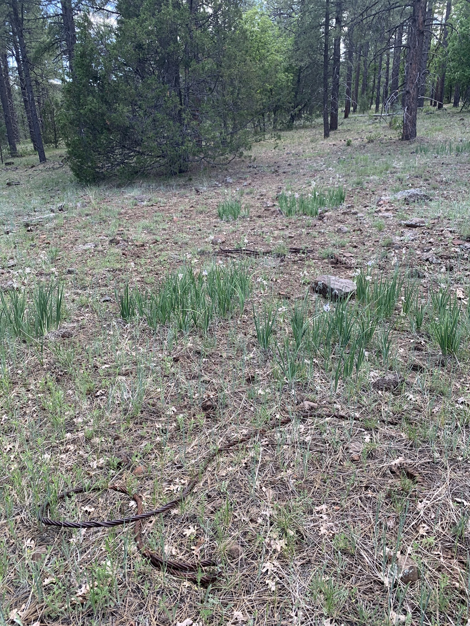
| Photo point 10. The grade is sweeping to the southwest into the Woody Ridge drainage. Note the ties, many still in place. |
It continues south down a gradual slope and makes a wide turn as it crosses Woody Wash. A short trestle was used to negotiate the hill.
|
|
|
 |
Photo point 11. The remains of a trestle where the grade drops into the Woody Ridge drainage.
The grade swings to the south side of the drainage and continues east. The drainage quickly becomes narrow and, at this point, it is several feet above the drainage bottom with an impressive rock wall keeping it in place.
 |
Photo point 12. Grade on the south side of Woody Wash.
Highway 89a is quickly reached. At this point, the grade crossed Woody Wash. There is little evidence of it because nearly a century of runoff has obliterated it. The wash turns to the south and the grade continues on the east side of it. It is directly below the highway but not easily seen from the road when driving by at 55 mph.
|
|
 |
Photo point 13. The grade is running left to right in the center of the photo. The Highway 89a guardrail is visible.
The grade parallels the highway for a couple hundred yards and follows Woody Wash to the east side of the highway. The construction of the highway bridge completely wiped out any evidence of the grade in the vicinity of the bridge. A 1912 U.S. Geological Survey topographic map shows that a road from Flagstaff to Sedona existed in pretty much the same location as the current highway. It'd be interesting to know what the crossing looked like.
 |
1912 topographic map showing where the Flagstaff to Sedona road crossed Woody
wash.
After crossing Woody Wash on the highway, the grade is easily seen directly adjacent to the road. It gets even closer to the highway the further south it goes.
 |
Photo point 14. View north along the grade directly to the east of Highway 89a.
|
 |
Photo point 14. Just south from above photo. The highway can be see in the upper left.
The grade soon angles to the southeast, following Woody Wash. Much of it has been washed away over the past 90+ years but there is enough still in place to follow it.
 |
Photo point 15. Grade heading southeast from the highway.
 |
Photo point 15. Further southeast than above photo. A couple of ties are visible.
|
The grade continues southeast where it soon comes to a quarry that covers several acres. There is absolutely no sign of the grade in this area. I'm guessing it continued to follow Woody Wash for several hundred yards. At this point the drainage becomes quite deep. There is also a short but somewhat steep hill that the grade had to negotiate to get onto the high point just to the south. There would have been a trestle here but the only evidence of one are two large timbers that are just downstream in the drainage. There is an old road in this area and it seems likely the grade would have followed the general path of the road.
 |
Photo point 16. Timbers downstream in Woody Wash. These may have been part of a trestle.
|
There is no evidence of the line for several hundred meters until a rough two-track (FR 533F) is reached. This road was built on top of, or directly to, the line. The grade goes both to the east and west. The line to the west appears to end very close to Highway 89. The main line heads east. Photo point 17(next two photos) shows the grade as it begins its turn to the south and then quickly heads to the southwest. There is some impressive rockwork on this stretch of the grade.
The grade forks in the southeast corner of Section 26. The line to the west ends near Highway 89. This portion of the grade may have accessed a camp and/or maintenance area. There is some scattered camp related trash (although not nearly as much as I've seen at other sites) and there are scattered rock piles and depressions.
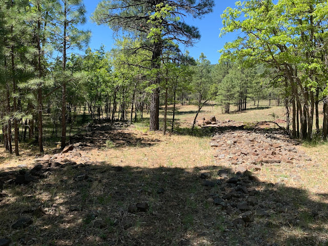
Photo point 18 Fork in the line located in the southeast corner of Section 26. The segment to the right goes west and ends near Highway 89. The main segment to the left quickly curves to the south.
The main line continues south. It crosses a small drainage and then becomes somewhat difficult to follow. There is a good bit of disturbance in this area which is perhaps related to more recent logging operations.
|
Photo point 19. The grade becomes difficult to follow just south of this point.
Forest Road 9482V is soon reached at the northern end of Section 35. This road was constructed on top of and adjacent to the railroad grade. There is another fork right at 9482V and Highway 89. I've been by this spot many times and have never realized that this fork existed.
Photo point 20 The grade is visible as it head southwest. Highway 89 is in the background.
The line continues on the west side of Highway 89. It isn't terribly obvious but is pretty easy to follow. The fence runs along the line for a hundred meters or so but eventually veers slightly to the southwest away from the highway.

Photo point 21. The grade is visible under the fence line. The clump of oak are on the grade. Highway 89 is in the background. View is to the northeast.
| 
Photo point 21. The grade where it veers off to the southwest.
|
The gradee is easily followed until it eventually ends at the north edge of Fry Canyon.
Photo point 22.
| | Photo point 23. The grade ends at this point. Fry Canyon is just south of this location. |
The left, or eastern segment of the line from the fork in Section 35, veers to the southeast to nearly the edge of bench above Pumphouse Wash. The grade is adjacent to the road for much of the way and ends close to the southern end of the bench above Fry Canyon.
Photo point 24.
Photo point 25. The end of the grade with the rim of Fry Canyon in the background.
Stein (1993) has a map showing a spur heading due east over Pumphouse Wash. The topography in the area makes it extremely unlikely that such a spur ever existed. The photos below show Pumphouse Wash in the general area of the supposed spur.
|
|
|
|


Hey would love to chat about this research, ccd226@nau.edu
ReplyDelete